Learn the name first
Barangaroo is named after Barangaroo, a Cammeraygal woman and leader of the Eora Nation, according to the precinct's own history pages. The Gadigal people are the Traditional Custodians of this land, and the precinct describes the foreshore as a place used for hunting, fishing, canoeing, swimming and gathering, with more than 7,000 years of history. Within living memory it was a container terminal. Today the precinct says at least half of it is public open space.
Follow Wulugul Walk
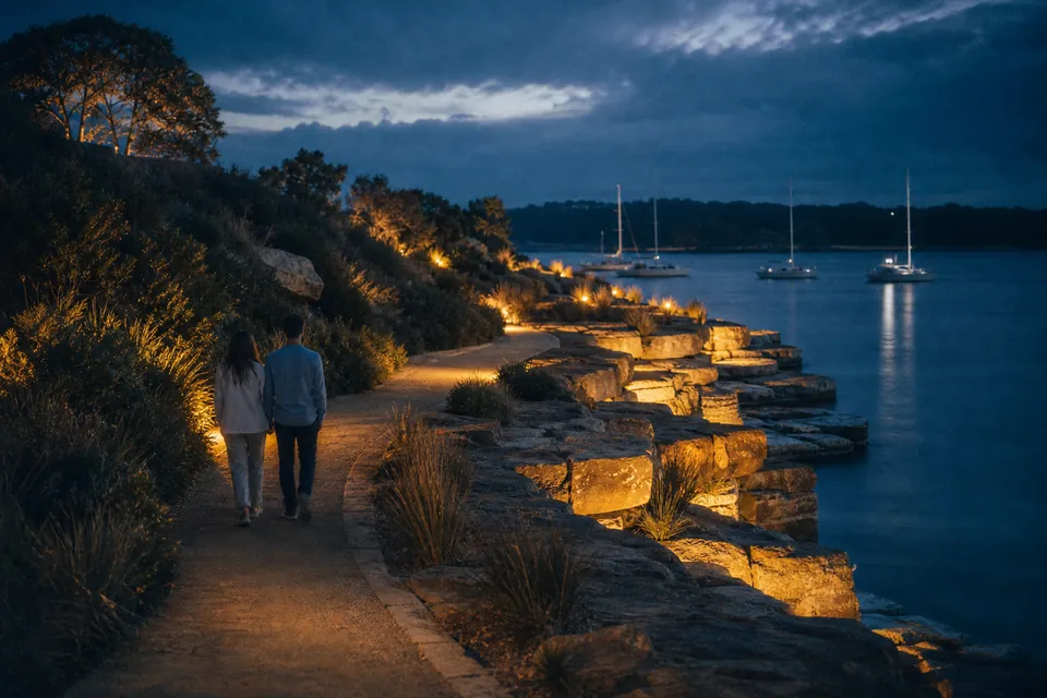
Wulugul Walk is the foreshore promenade that runs along the water from the restaurants at Barangaroo South towards the reserve. In the evening it's the obvious walk after dinner: flat, lit, and with the harbour on your left the whole way north. The precinct counts more than 50 restaurants, cafes, bars and shops across Barangaroo, most of them along this edge.
Climb onto the headland
Barangaroo Reserve is a six-hectare headland at the northern end, with lookouts, walking and cycling paths, coves, swimming and picnic spots. The precinct describes its planting as the only truly native flora experience around Sydney Harbour. At dusk the sandstone steps along the water catch the last light and the paths empty out.
Under the reserve is the Cutaway, an events and cultural space carved from the sandstone; check the precinct's calendar to see if anything's on.
Swim at Marrinawi Cove
At the northern end of the reserve, the NSW Government has opened a swimming enclosure at Marrinawi Cove, part of an effort to bring swimming back to the harbour. The reserve starts about ten minutes' walk north of Barangaroo Wharf, per the precinct, and the cove is at its far end. On a hot afternoon it feels a long way from the hotel pool.
Carry on to the Rocks
The short way
From the reserve, the Argyle Cut leads up and over to the Rocks: past the Lord Nelson Hotel and down Argyle Street to the Museum of Contemporary Art at Circular Quay. The precinct puts it at about 1 kilometre, fully accessible with a short incline.
The water way
Stay on the edge: Walsh Bay, under the Harbour Bridge, Campbell's Cove, the Overseas Passenger Terminal, Circular Quay. About 1.9 kilometres, flat and fully accessible, per the precinct.
The way back
Take whichever you didn't take on the way out, or catch a ferry from Circular Quay one stop to Barangaroo Wharf.
Know what's still being built
Central Barangaroo, between the tower end and the reserve, is the final stage of the precinct. The precinct plans Harbour Park there, 1.85 hectares on the foreshore. Building work is part of why some Crown room pages warn that construction may be visible from the window, and why some footpaths around Hickson Road have been diverted. Wulugul Walk along the water is the reliable route.
Put it in your evening
Our one-night plan uses the reserve at dusk and the promenade after dinner. If you only do one thing outside the tower, make it the walk to the headland as the light goes.
Checked against Crown Sydney's own pages on 1 November 2026. Hours, prices and menus change; confirm with the venue.